A Proposal Worth Understanding in Full
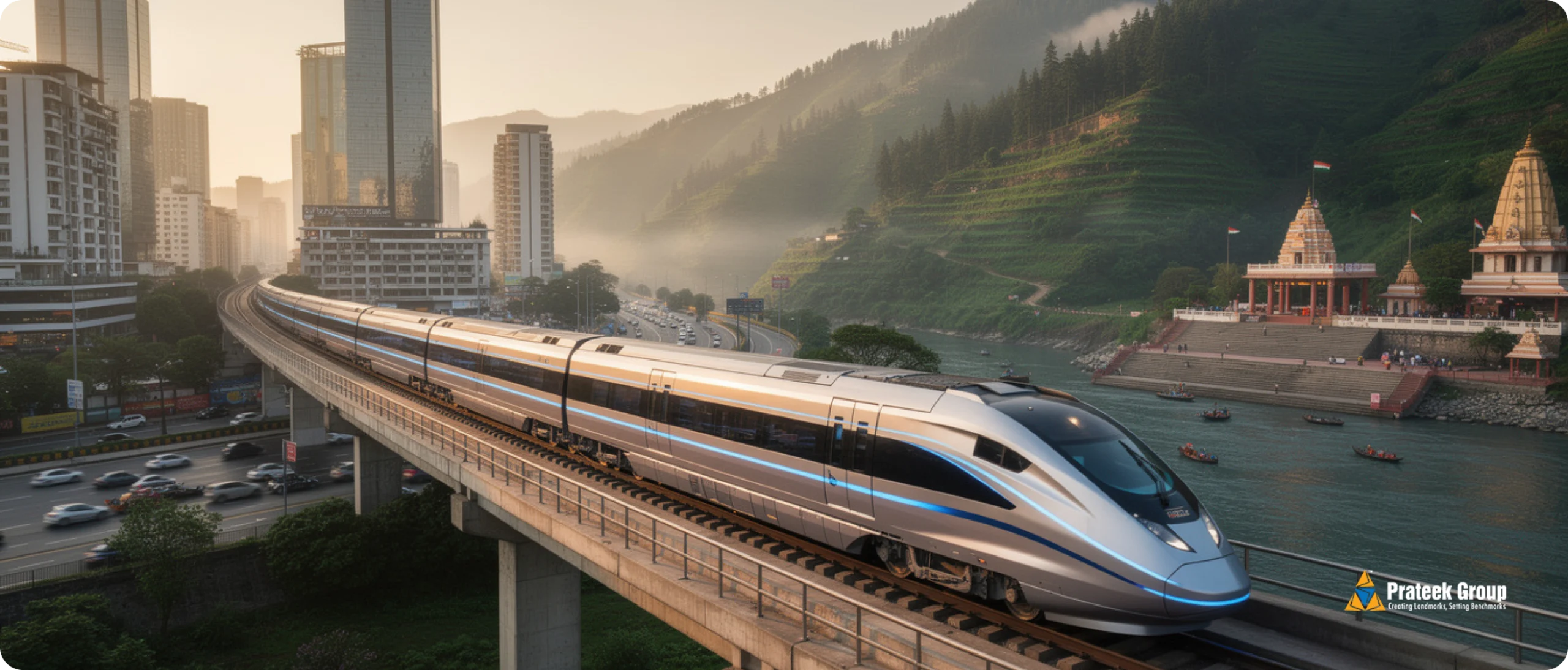
On April 10, 2026, reports confirmed that Uttarakhand Chief Minister Pushkar Singh Dhami met Union Housing and Urban Affairs Minister Manohar Lal Khattar to discuss extending the Namo Bharat Regional Rapid Transit System (RRTS) from its current terminus at Modipuram in Meerut northward to Haridwar and Rishikesh. Alongside this, the state proposed a separate metro corridor connecting Dehradun, Haridwar, and Rishikesh. Together, the two proposals could create continuous high-speed rail connectivity from Delhi to the Himalayan foothills.
The proposed RRTS extension would follow the NH-58 alignment from Modipuram, with planned stations at Daurala, Sakauti, Khatauli, and Purkazi near the UP-Uttarakhand border, then Roorkee, and finally Jwalapur in Haridwar and Rishikesh. If built at the same operational speed as the existing Delhi-Meerut corridor (160 km/h), the travel time from Sarai Kale Khan in Delhi to Haridwar would fall to roughly two and a half hours. To Rishikesh, about three hours. The current road journey takes six to seven hours.
Uttarakhand has reportedly sought Rs 750 crore for initial infrastructure upgrades, including automated power systems and underground cabling for the eco-sensitive Kumbh region, where conventional overhead electrification would not be permitted.
This is a proposal, not a sanctioned project. No Detailed Project Report (DPR) has been submitted. No construction timeline exists. That distinction matters throughout this analysis. But the proposal sits inside a much larger pattern of regional rail investment that is already reshaping how cities in the National Capital Region function, where people choose to live, and where property values are moving. Understanding that pattern is what this article is about.
The RRTS Network: What Already Exists and What Is in Motion
The Namo Bharat RRTS is not a single train line. It is a planned network of eight corridors radiating out of Delhi, designed to carry semi-high-speed trains at 160 km/h (with a design speed of 180 km/h) and cover 100 km in under 50 minutes. The system is operated by the National Capital Region Transport Corporation (NCRTC), a joint venture of the central government and the states of Delhi, Haryana, Rajasthan, and Uttar Pradesh. Deutsche Bahn, Germany’s national railway company, manages day-to-day operations under a 12-year contract with a five-year extension option.
Within Delhi, RRTS runs underground. Outside Delhi, it runs elevated. The system integrates with the Delhi Metro at stations like New Ashok Nagar, Anand Vihar, and Sarai Kale Khan. Stations feature airport-style amenities: check-in kiosks, platform screen doors, food vending machines, onboard catering, washrooms, WiFi, CCTV, childcare facilities, and dedicated coaches for women and physically-challenged passengers. Trains are manufactured by Alstom at their Savli plant in Gujarat.
The NCRTC’s model is comparable to London’s Crossrail (Elizabeth Line), Paris’s RER network, and Munich’s S-Bahn. All three are regional rail systems that extend beyond the city core to connect suburban and satellite cities at speeds significantly faster than metro systems. The RRTS is India’s first system in this category.
The Delhi-Ghaziabad-Meerut Corridor: Now Fully Operational
The first corridor became fully operational on February 22, 2026, when Prime Minister Narendra Modi inaugurated the remaining sections from Sarai Kale Khan to New Ashok Nagar in Delhi, and from Meerut South to Modipuram in Uttar Pradesh. The full corridor spans 82.15 km with 16 stations and was built at a cost exceeding Rs 30,000 crore, funded by loans from the Asian Development Bank ($1 billion), the New Development Bank ($500 million), and the Asian Infrastructure Investment Bank ($500 million).
The journey from Sarai Kale Khan in Delhi to Modipuram in Meerut now takes approximately 55 to 60 minutes. By road, the same journey takes two and a half to three hours during peak hours. The corridor passes through Ghaziabad, one of NCR’s densest urban centres, with stations at Sahibabad, Ghaziabad, and multiple stops through Modinagar into Meerut.
Ridership: The Numbers Tell the Story
On February 23, 2026, the first full day of operations on the complete corridor, the RRTS recorded over 1 lakh (100,000) passengers. This was the highest single-day ridership ever recorded on the system. For context, when the first 17 km section opened in October 2023 (Sahibabad to Duhai Depot), daily ridership was 2,500 to 3,000. When the corridor extended to 34 km in March 2024, ridership rose to about 12,000 per day. The full corridor is projected to reach 8 lakh (800,000) passengers per day as the system matures.
That growth trajectory matters for understanding real estate impact. It shows that ridership scales non-linearly with network length. Each new section does not just add riders proportional to its own length. It increases the utility of the entire system, drawing in riders who previously found the partial corridor insufficient for their commute. This is the network effect in action, and it is the same dynamic that would apply if the corridor extends further north to Haridwar.
The NCRTC reported that the full corridor opening shifted the modal share for the Delhi-Meerut travel corridor from 37% public transport to 63% public transport. That is a radical change. It means the RRTS did not just absorb existing public transport riders. It pulled a significant number of people out of cars and off the highway.
The Other Corridors: What Is Coming Next
| Corridor | Length | Stations | Est. Cost | Status (April 2026) |
|---|---|---|---|---|
| Delhi-Ghaziabad-Meerut | 82 km | 16 | Rs 30,000+ Cr | Fully operational (Feb 2026) |
| Delhi-Gurugram-SNB-Alwar | 164 km | 22 | Rs 37,000 Cr | Construction from Aug 2026 |
| Delhi-Panipat-Karnal | 136 km | 16 | TBD | Groundwork underway (Apr 2026) |
| Ghaziabad-Jewar Airport | 72 km | TBD | TBD | Planning stage |
| Delhi-Faridabad-Palwal | 60 km | TBD | TBD | No DPR submitted yet |
| Delhi-Rohtak-Hisar | TBD | TBD | TBD | No DPR submitted yet |
| Ghaziabad-Hapur | TBD | TBD | TBD | Under consideration |
| Meerut-Haridwar-Rishikesh | ~150+ km | ~8-10 | TBD | Proposal stage (Apr 2026) |
All Phase 1 corridors converge at Sarai Kale Khan station in Delhi, making it a hub where passengers can transfer between corridors without changing platforms. The system is designed to be interoperable: a train from the Meerut corridor and a train from the Panipat corridor use the same gauge, the same signalling system, and the same station infrastructure. This interoperability is what makes the RRTS a network rather than a collection of independent lines.
The Ghaziabad-Jewar corridor is particularly relevant for Noida. If built, it would connect the RRTS network directly to the Noida International Airport, which was inaugurated on March 28, 2026. That would place the airport within the RRTS catchment, adding air connectivity to a system that already provides high-speed rail and metro access.
The Global Precedent: What London's Elizabeth Line Did to Property Values
To understand what the RRTS might do to property values in NCR over the next decade, the closest available precedent is London’s Elizabeth Line (formerly Crossrail). The parallels are strong. Both are regional rail systems designed to extend the commutable radius of a major capital city. Both connect the urban core to satellite towns at speeds significantly faster than existing metro systems. Both cost tens of billions. And both created measurable, well-documented effects on property markets.
London’s Elizabeth Line is a 118 km railway linking Reading and Heathrow in the west to Abbey Wood and Shenfield in the east, passing through 41 stations including 10 newly built ones. Construction began in 2009 and full operations started in May 2022. The project cost approximately 19 billion pounds (roughly Rs 2 lakh crore at current exchange rates).
Here is what happened to property values:
The Numbers from London
Overall price growth: A City Monitor analysis found that average house prices around all Elizabeth Line stations rose 70% over the decade from announcement to opening. The London-wide average increase over the same period was 55%. That 15-percentage-point gap is the “Crossrail premium.”
Eastern stations (where connectivity improved most): Maryland station in Newham saw a 108% price increase over ten years. Stratford and Abbey Wood saw prices double. The inner east stations, from Stratford to Manor Park and Custom House to Abbey Wood, saw the highest absolute price growth.
Outer stations (new commuter access): Ealing Broadway prices rose 42%, Southall rose 48%. These were areas where the Elizabeth Line cut journey times to central London by 10 to 20 minutes, making them viable commuter locations for the first time.
Rentals: Since the line opened in May 2022, average rents near Elizabeth Line stations rose 31% over three years, compared to 25% across Greater London as a whole. Tottenham Court Road and Bond Street saw rental increases of up to 80%. Whitechapel followed at 73%. In outer areas, Slough rents rose 44% and Burnham 43%.
Early investor returns: Investors who bought near future stations in 2012 (when the project was announced) saw 88% appreciation in Newham and 78% in Ealing by 2025. Those who bought in 2020 (two years before opening) saw 10% in Newham and 16% in Ealing. The lesson: the largest gains go to early-stage investors who buy before the line is operational.
New build premium: New homes along the Elizabeth Line saw a 34% price increase since 2016, compared to 13% for existing stock. This suggests that new construction near transit stations captures a disproportionate share of the transit premium.
What This Means for the RRTS
The RRTS is at an earlier stage than where the Elizabeth Line was at opening. The Delhi-Meerut corridor has just become fully operational. The other corridors are in various stages of planning and early construction. If the Elizabeth Line pattern holds, the largest price appreciation along RRTS corridors will happen between now and full network completion, not after.
There are differences, of course. London is a more mature and expensive property market. The Indian regulatory environment is different. The purchasing power of NCR buyers is different from London buyers. But the mechanism is the same: when you reduce commute time to a city centre from a satellite location, you increase the residential desirability of that location, and prices follow.
The Savills research on the Elizabeth Line noted that the effect was strongest for stations where connectivity improved the most. In the RRTS context, that means corridor towns like Modinagar, Duhai, and eventually Muzaffarnagar, Roorkee, and Haridwar would see proportionally larger effects than Ghaziabad or Delhi stations, which are already well-connected.
The Economics of Expanding the Commutable Radius

In urban economics, the “commutable radius” defines how far from a city centre a person can live while reaching their workplace within a tolerable commute time. Research consistently shows that most workers accept a one-way commute of 45 to 60 minutes. Below that threshold, a location is a viable commuter suburb. Above it, the location functions as an independent city with its own economy.
Before the RRTS, Meerut was a separate city. The road journey to Delhi took two to three hours during peak hours. The train now does it in under 60 minutes. That single change has moved Meerut from one side of the 60-minute threshold to the other. In economic terms, Meerut has been absorbed into Delhi’s effective labour market. Workers who live in Meerut can now commute to jobs in Delhi. That was not practical before.
When the commutable radius expands, four things happen in sequence. First, land that was previously “too far away” becomes viable for residential development. Second, demand for housing in the newly accessible zone increases. Third, developers begin launching projects to meet that demand. Fourth, prices rise in the new zone, while existing well-connected suburbs hold or increase their values because the overall attractiveness of the region has improved.
This is precisely what Tokyo’s commuter rail expansion demonstrated in the 1960s and 70s. When the Tokaido Shinkansen and suburban rail networks expanded outward from central Tokyo, the inner suburbs (Yokohama, Kawasaki) did not lose value. They gained value, because the expansion of the rail network made the entire Tokyo metropolitan region more attractive as a place to live and work. The best-connected inner nodes benefited from the overall growth of the metropolitan economy.
The RRTS is doing this for Delhi-NCR at a larger scale than any previous Indian transit project.
What the Haridwar Extension Would Actually Do
It Does Not Create a Commuter Belt. It Creates an Accessible Tourism Zone.
The proposed Meerut-Haridwar extension does something different from the existing corridors. Few people will commute daily from Haridwar to Delhi. The travel time, even at 160 km/h, would be two and a half hours. That exceeds the 60-minute commute threshold that defines the practical commuter radius.
Instead, this extension collapses the distance between NCR’s 50-million-plus population and two of India’s most visited spiritual and tourism destinations. Currently, the NH-58 is heavily congested, particularly on weekends and during festivals like Kanwar Yatra and Kumbh Mela. A three-hour rail journey changes the Haridwar-Rishikesh trip from a planned expedition requiring a full day of travel into a viable weekend outing or even a day trip.
Industry estimates suggest a potential 200% increase in demand for holiday homes, rental villas, and homestays in the Uttarakhand foothills once high-speed rail access is established. Whether that precise figure materialises depends on execution, pricing, and the pace of supporting infrastructure development. But the directional logic is clear. When you reduce travel effort by half, you increase the pool of potential visitors and property buyers by a multiple, not an increment.
The Corridor Towns: A New Economic Geography
The proposed route passes through several towns that are currently small to mid-sized, with limited direct connectivity to Delhi. Each has its own economic profile that would be altered by an RRTS station.
Daurala and Khatauli are sugar mill towns in western Uttar Pradesh. Their economies are agricultural and small-industry based. An RRTS station would place them within 70 to 90 minutes of central Delhi, potentially attracting warehousing, logistics, and light manufacturing investment from companies looking for lower-cost locations with fast urban access.
Muzaffarnagar, while not on the proposed station list, lies between Meerut and Haridwar and could see indirect effects. It is already one of western UP’s larger commercial centres. If the corridor passes nearby, industrial and logistics interest would likely increase.
Roorkee is particularly interesting. It is home to IIT Roorkee, one of India’s oldest and most respected engineering institutions. The NCRTC has already signed a memorandum of understanding with IIT Roorkee for collaboration on urban mobility research. Faster connectivity to Delhi would increase demand for student housing, faculty residences, research-adjacent commercial space, and conference or visiting-scholar accommodation. Roorkee’s transformation would resemble what happened to towns near major UK universities (like Reading) after Crossrail connected them to London.
Haridwar and Rishikesh would see the most direct tourism and hospitality impact. Both cities receive millions of visitors annually for religious tourism, yoga, adventure sports, and wellness retreats. The constraint on visitor numbers has not been demand (which is enormous) but access (which is slow and unreliable by road). High-speed rail access from Delhi would remove that constraint. The service economy, from hotels to restaurants to wellness centres, would scale accordingly.
The Two-Directional Effect on NCR's Real Estate
Most coverage of the RRTS extension focuses on what it does for Haridwar and Rishikesh. That is understandable. But the effect flows in both directions, and the impact on NCR’s own housing market is the part that matters most for homebuyers in Noida and Ghaziabad.
Effect 1: Meerut Becomes an Interchange Hub, Not a Terminal
Modipuram in Meerut is currently the northern terminus of the RRTS. If the Haridwar extension is built, Modipuram becomes an interchange hub: not the end of the line, but a mid-point through which traffic passes. That is a fundamentally different position in a transport network.
In every transit system in the world, interchange stations generate higher property values than terminal stations. Terminal stations see traffic that originates or terminates there. Interchange stations see through-traffic, local traffic, and transfer traffic. The London data shows this clearly: Stratford, where the Elizabeth Line intersects with the Central Line, the Jubilee Line, the DLR, and the Overground, saw among the highest price growth on the entire Crossrail route.
The Meerut Metro, which already shares four stations with the RRTS (Modipuram, Begumpul, Shatabdi Nagar, and Meerut South), extends the local catchment. A northward RRTS extension would make Meerut a mid-corridor city connected to both Delhi (60 minutes south) and Haridwar (90 minutes north). That positioning is substantially more valuable than being at the end of the line.
Effect 2: The Relative Centrality of Ghaziabad and Noida Increases
Here is where the analysis becomes directly relevant for property buyers in Noida and Ghaziabad.
The RRTS network is designed to be interoperable. All three Phase 1 corridors converge at Sarai Kale Khan. A passenger from Haridwar could, in principle, travel to Sarai Kale Khan and transfer to the Delhi-Alwar corridor heading toward Gurugram, or connect to the Delhi Metro network to reach Noida. The Ghaziabad-Jewar RRTS corridor, if built, would extend this connectivity south from Ghaziabad directly to the Noida International Airport.
But the more immediate effect is perceptual and economic. When the RRTS makes Meerut accessible in under 60 minutes and eventually Haridwar in under three hours, it redefines what “close” means in the NCR. Cities that are under 30 minutes from Delhi by RRTS (Ghaziabad) or under 30 minutes by Metro (Noida) start to look very central in comparison. The outer boundary of the metropolitan region has moved further out, and the inner ring gains relative proximity.
This relative proximity effect has been studied extensively. When suburban commuter rail expanded in Tokyo in the 1960s and 70s, the inner suburbs that were already well-connected saw sustained price appreciation. Their own infrastructure did not change. What changed was that the broader network made the region more attractive overall, and they were the best-connected nodes within it.
Noida already has a connectivity profile that is genuinely multi-modal: the Delhi Metro (Blue Line and Aqua Line), the Noida-Greater Noida Expressway, the Yamuna Expressway, the Noida International Airport (inaugurated March 2026), the planned 10-lane Yamuna Pushta Road corridor from Sector 94 to Sector 150, the Chilla Elevated Road under construction, and the Ghaziabad-Jewar RRTS corridor in planning. Prateek Group’s analysis of how urban infrastructure reshapes property prices in Delhi NCR tracks this relationship with specific data.
Effect 3: The Second-Home Economy
The RRTS extension to Haridwar and Rishikesh would create something the NCR does not currently have at scale: a high-speed-rail-accessible second-home market. Currently, NCR residents who want a weekend home or holiday property typically look at Shimla, Mussoorie, Nainital, or Jim Corbett. All of these destinations require five to eight hours of driving.
A three-hour train journey to Rishikesh changes the economics of second-home ownership. The property is close enough to use on a regular basis, not just for annual vacations. The rental potential increases because the pool of potential short-stay renters expands to include anyone in the NCR who can reach it in three hours. The property can be managed more easily because the owner can visit frequently.
This is similar to what happened with London-to-Brighton rail connectivity, or Tokyo-to-Karuizawa Shinkansen access. In both cases, high-speed rail created a second-home market in locations that were previously too far for regular weekend use. Property values in those destinations rose, but so did property values in the origin cities, because the lifestyle proposition of living in the city improved. If you live in Noida and can reach Rishikesh in three hours on a Friday evening, Noida becomes a more attractive place to live overall.
What Existing Data Shows About Transit and Property Prices in NCR
The National Housing Bank’s data shows that properties within 1 km of major transit corridors in Delhi NCR command 10% to 30% higher prices than those 2 to 3 km away. This is consistent with the global evidence. London’s Elizabeth Line saw a 6% to 15% premium for properties near stations compared to surrounding areas. An American Public Transportation Association study found residential property values near transit stations averaged 4% to 24% higher.
In Noida specifically, ANAROCK data shows average residential prices rising from Rs 4,795 per sq ft in 2020 to Rs 9,200 per sq ft by Q1 2025. That is a 92% increase in five years. The Square Yards “Runway to Realty” report records that apartment prices along the Yamuna Expressway corridor nearly tripled between 2020 and 2025. Unsold inventory in Noida dropped 72% in the same period.
The Ghaziabad corridor, which the RRTS passes through directly, has seen similar patterns. Areas along the Delhi-Meerut RRTS route, particularly around Duhai and Modinagar, have seen increased buyer interest since stations opened. Ghaziabad and Sahibabad stations have become highly valued transit points. The Sahibabad to New Ashok Nagar stretch, just 13 km, takes 6 minutes by RRTS compared to 30 minutes by Metro. That time saving is the kind of concrete improvement that moves buyer decisions.
For projects in Noida like Prateek Stylome in Sector 45, Prateek Fedora in Sector 61, Prateek Wisteria in Sector 77, and Prateek Laurel in Sector 120, the relevant infrastructure is not the RRTS directly (these sectors are on the Metro and expressway network, not the RRTS route). The relevance is indirect: as the RRTS network expands, it pulls more economic activity into the NCR, increases the total labour pool, supports job creation in the region, and makes the NCR as a whole more competitive with other Indian metropolitan areas. Well-connected sectors within Noida benefit from that overall growth.
In Ghaziabad, where Prateek Grand City is located on NH-24 in Siddharth Vihar, the RRTS effect is more direct. The project benefits from proximity to Ghaziabad Railway Station, Metro stations, and the Delhi-Meerut Expressway. As the RRTS network expands both northward (toward Haridwar) and southward (the planned Ghaziabad-Jewar corridor to the airport), Ghaziabad’s position as a transit hub strengthens.
Sector 150 in Noida, where Prateek Canary is located, sits at the intersection of the Noida-Greater Noida Expressway, the Yamuna Expressway, and the upcoming Yamuna Pushta Road corridor. That multi-modal connectivity is the type of infrastructure layering that correlates most strongly with sustained price appreciation in global studies. A detailed analysis of why Sector 150 is drawing investor attention covers the growth factors in depth.
What Still Needs to Happen, and What Could Go Wrong
Critical analysis requires acknowledging the gaps between a proposal and a completed project.
The Approval and Timeline Reality
No DPR exists yet. The Haridwar extension is a high-level policy conversation, not an engineering document. The NCRTC would need to commission feasibility studies and route alignment analysis. For context, the Delhi-Meerut DPR was approved in May 2017 and the corridor opened in February 2026. That is nearly nine years from DPR to full operation.
Two-state coordination is required. The route spans UP and Uttarakhand. Both state governments, plus the centre, must sign off. The Delhi-Alwar corridor required separate approvals from Haryana and Rajasthan, which contributed to multi-year delays. Political alignment helps (UP and Uttarakhand currently have the same ruling party as the centre), but alignment is not permanent.
Funding at scale. The Delhi-Meerut corridor cost over Rs 30,000 crore for 82 km. The Delhi-Alwar corridor is estimated at Rs 37,000 crore for 164 km. The Meerut-Haridwar extension would likely cost tens of thousands of crores. Multilateral development banks (ADB, AIIB, NDB) have funded previous corridors, but loan approvals and disbursement processes take years.
Environmental clearances. The route passes through the Kumbh region, which has specific environmental sensitivities. The Rs 750 crore sought for underground cabling reflects awareness that conventional infrastructure will not be permitted in all sections. Environmental impact assessments, public hearings, and clearances add time.
Execution Risk: Lessons from the Delhi-Meerut Experience
The Delhi-Meerut corridor itself provides a cautionary example. Originally planned for full commissioning by 2024, it was only partially operational from October 2023 to February 2026. The rollout happened in five phases over 28 months, with each phase missing its original deadline by several months. Causes included pending station work in Ghaziabad, safety inspection delays, and the complexity of integrating underground sections in Delhi.
These delays did not prevent the corridor from being built. They did extend the timeline significantly. Any estimate for the Haridwar extension should build in similar execution risk. A realistic timeline would be seven to twelve years from DPR approval to full operation. That puts commercial service somewhere between 2033 and 2038.
For property buyers, that means this extension is a long-horizon signal, not an immediate catalyst. The sectors and cities most affected are those in the extended corridor, not in Noida proper. But the cumulative effect of the expanding RRTS network on the NCR economy is an ongoing, present-tense factor, not a future one.
What This Means for Property Buyers in NCR Today

The Haridwar-Rishikesh extension is one piece in a larger pattern. That pattern is this: the Indian government is building a high-speed regional rail network that will, over the next decade, connect every major city and town within 200 km of Delhi into a single commuter and economic zone.
The Delhi-Meerut corridor is operational. Delhi-Panipat-Karnal groundwork has started. Delhi-Gurugram-Alwar construction begins in August 2026. Ghaziabad-Jewar is planned. Meerut-Haridwar is proposed. The total network, when complete, would cover over 1,000 km.
When you step back and look at this as a network rather than individual projects, the implication for real estate is straightforward: cities and sectors that sit at the intersection of multiple transit modes will see the strongest demand over the next decade. The more connections a location has, the more resilient its property values are to any single project delay.
Noida currently sits at the intersection of the Delhi Metro, the Noida-Greater Noida Expressway, the Yamuna Expressway, the Noida International Airport, and the planned Ghaziabad-Jewar RRTS corridor. Central Noida sectors (45, 61, 77, 120) are mature residential areas with established social infrastructure. Emerging sectors like 150 combine new development with expressway connectivity and planned road upgrades. Ghaziabad, on the RRTS route, is seeing the transit effect in real time.
Prateek Group’s projects across Noida and Ghaziabad are positioned in several of these multi-modal sectors. The question for any buyer evaluating a property in these areas is not “will this specific RRTS extension get built on schedule?” The right question is: “Is the property I am considering located at a point where multiple transit systems intersect?” If the answer is yes, the long-term direction is fairly clear, regardless of which individual project finishes first.
The Long View
There is an argument that the RRTS network is the single most transformative infrastructure investment in the NCR since the Delhi Metro was built in the early 2000s. The Metro created urban connectivity within Delhi. The RRTS is creating regional connectivity across the NCR and potentially beyond. One shrinks distances within the city. The other shrinks distances between cities.
The Delhi Metro’s impact on NCR real estate is well-documented. Sectors near Metro stations consistently outperformed those without Metro access, both in price appreciation and in rental yields, throughout the 2000s and 2010s. The RRTS is doing the same thing at a larger geographic scale.
The Haridwar-Rishikesh extension, if it happens, pushes that connectivity beyond the NCR and into a tourism and pilgrimage belt with year-round demand. The economic logic is sound: you have a 50-million-plus population centre on one end and two of India’s most visited spiritual destinations on the other, connected by a high-speed rail system that already exists for 82 km of the route.
Whether the extension is built in eight years or twelve, the direction is set. NCR’s transit network is expanding outward. Every expansion raises the value of nodes that are already well-connected. And every expansion makes the case stronger for buying in locations that have multiple forms of connectivity rather than relying on a single road or a single rail line.
The families who bought near Delhi Metro stations in 2005 understood this instinctively, even if they could not articulate it in economic terms. They bought at a place where infrastructure was converging, and they held. The same logic applies today, at a larger scale, with the RRTS network. The question is not which specific corridor gets completed first. The question is whether you are at a node where the infrastructure is converging. If you are, the network does the rest.